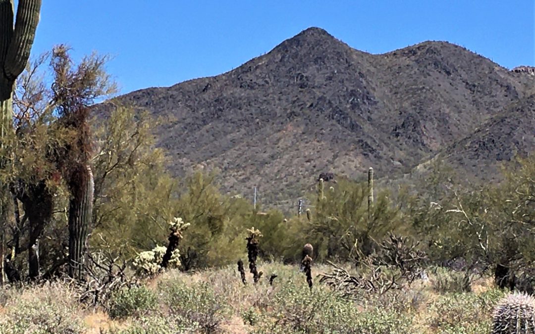
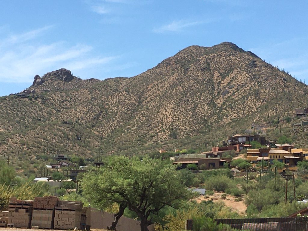
Have you ever heard of Cave Creek, Arizona? Usually, only people who have lived in the Phoenix area or who have visited frequently know where to find Cave Creek, but most people who have been there remember it. From Phoenix Sky Harbor Airport, Cave Creek is about a fifty-minute drive due north. It is nestled around a Native American landmark, Black Mountain.
A visual that might help is if you think of Phoenix as a big square. Add Scottsdale as a long skinny rectangle matched along the bottom edge and standing upright on the right side of that square. Then Cave Creek is a square above Phoenix that completes the picture to roughly make one huge rectangle. That’s not 100% topographically accurate, and it leaves out Carefree which cuts out the bottom right corner of Cave Creek, but it will help orient you.
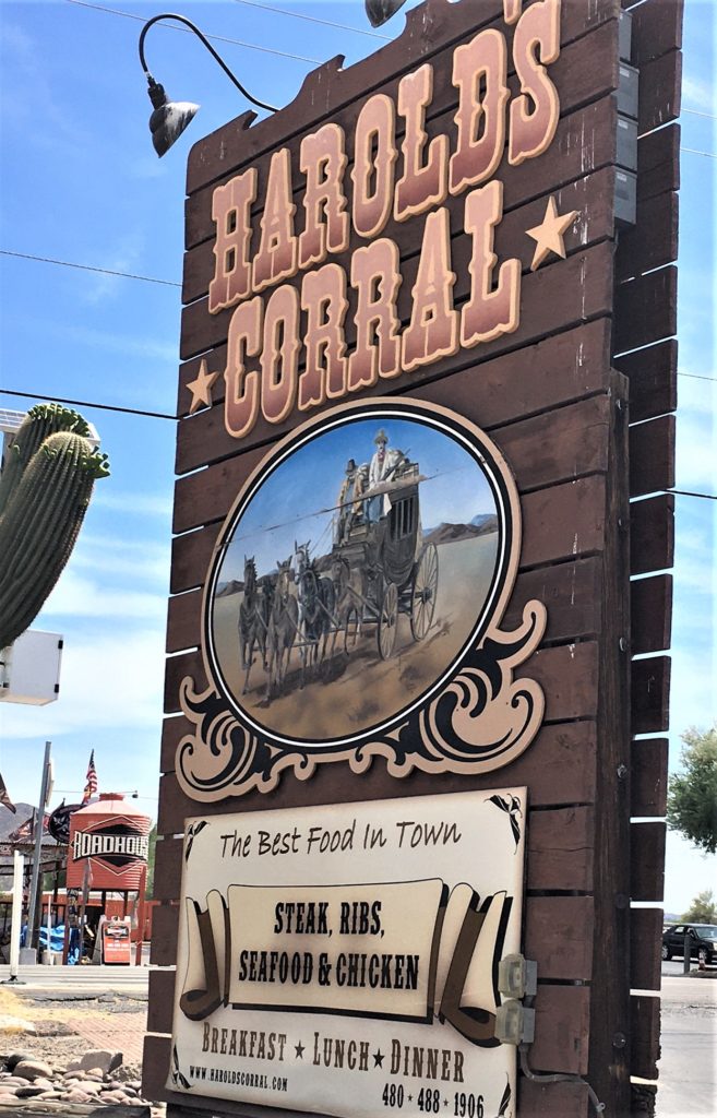

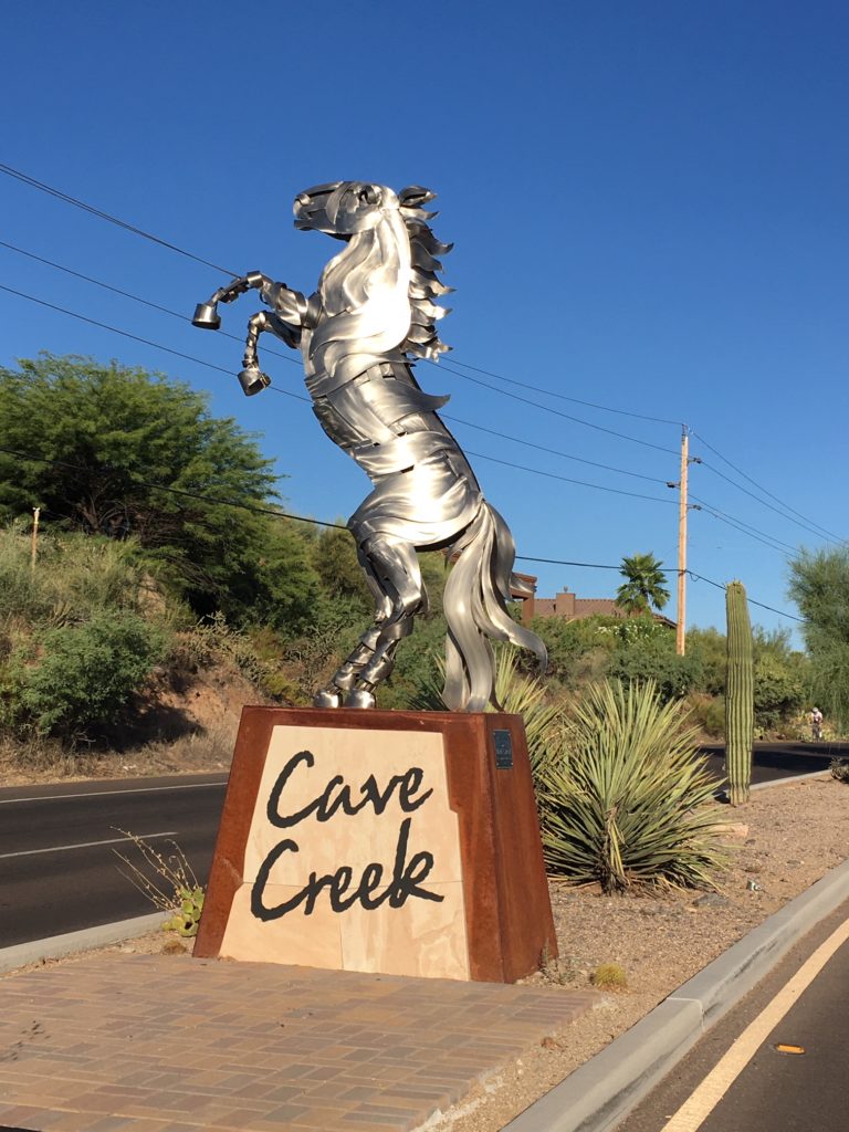
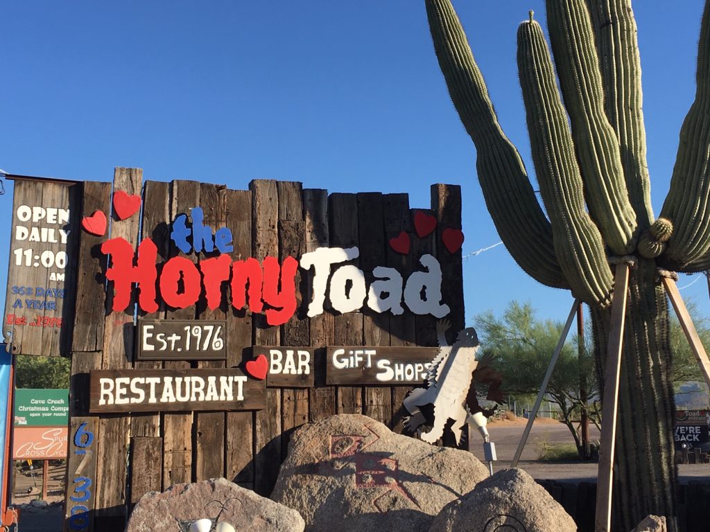
The towns of Cave Creek and Carefree are compatible neighbors and have a joint Chamber of Commerce, but they could not be more different in “ambiance.” Cave Creek is the cowboy town with bull riding twice a week at the Buffalo Chip and restaurants like the Horny Toad, Tonto Bar and Grill, and Harold’s Corral. Carefree is much more upscale, especially in the central area, with cobblestone streets, a large garden area featuring a giant sundial (See the Carefree Desert Gardens blog) and an outdoor stage. In Carefree you will find restaurants like The English Rose Tearoom and Keeler’s Steak House.
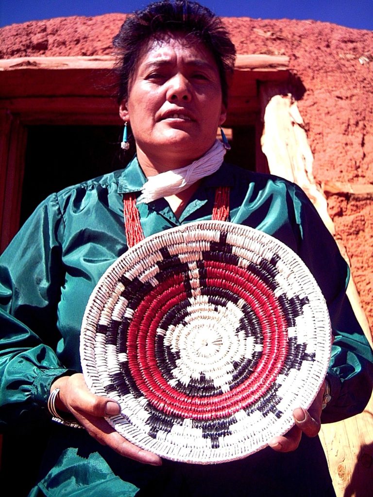
The origin of the two towns is different as well. The area which includes Cave Creek and Carefree was originally settled sometime after 500 A.D. by the Hohokam people who built extensive irrigation systems and trade routes. In Phoenix, some of the original canal paths they constructed to water their crops of corn, beans, squash and cotton are still in use today, and cotton is still an important crop there.
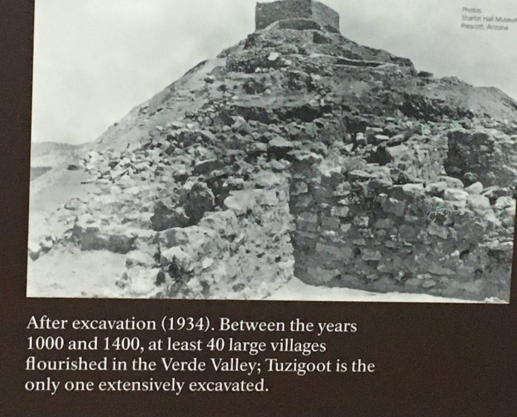
The Hohokam were potters and craftsmen as well as famers and traders. Their architecture developed from simple pit houses around a shared courtyard to above-ground structures with a plaza and enclosed by adobe walls. For a time, they built ball courts similar to those of the Mayans, and later they replaced these with raised mounds, probably used for ceremony. Around 1400, the Hohokam as a culture disappeared, possibly being absorbed by the Apache immigrants from the north and east.
Further north and east in Arizona, the Hopi people from Mexico settled in the Four Corners area. Originally hunters and gathers, the Hopi developed agriculture around 700 A.D. and that let to the people settling together on the mesa tops and farming the land around the base of the mesa. By 1400, they had an annual ceremonial calendar, a complex social structure and advanced agricultural practices.
Life was very peaceful for the Hopi until 1500 when the Spanish came looking for the legendary Seven Cities of Gold. The first group was let by Don Pedro de Tovar, and eventually the Hopi accepted and assisted them. By 1700, when the Spanish couldn’t find gold and got tired of fighting the fierce, inhospitable Apaches, they returned to Mexico.
Contact with the Spanish was definitely a mixed blessing. The native peoples of Arizona acquired from them horses, donkeys, cattle and sheep. The Spanish also introduced new fruits and vegetables. However, they also brought with them diseases such as smallpox which were devastating to the indigenous populations.
The Navajo arrived in the Hopi lands in the late 1600’s, forced to move west as the European settlements expanded. The Navajo took over Hopi rangeland, farm fields and water resources as well as raiding the Hopi villages. The Navajo attacks lasted until 1864 when they were forced onto reservations. Today, most Hopi live on Black Mesa and are surrounded by Navajo lands.
The Apache are related to the Navajo, both groups being Athabascan, along with some of the native Alaskan groups. These cultures crossed the Bering Strait from Siberia. Researchers brought Navajo, Alaskan Athabascan, Apache and Siberian Nomads together and discovered they all still share some common words, legends, and creation stories.
New Mexico and Arizona were initially claimed by explorer Francisco Coronado, became part of New Spain and were controlled by the Spanish government. From 1808 to 1821, there were a series of military battles and political struggles called the Mexican War of Independence. The conflict ended with the Treaty of Cordoba when the mainland of New Spain became the Mexican Empire. Then that government was overthrown in 1823 and Mexico was declared a federal republic. Spain officially recognized the independence of Mexico in 1836.
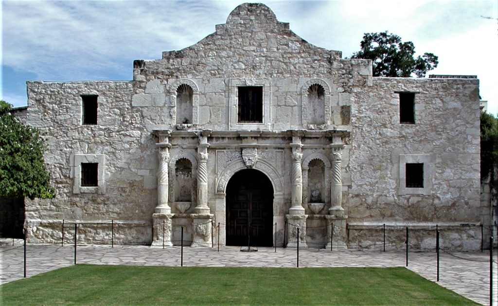
From 1846 to 1848, the U.S. was at war with Mexico, a conflict made famous by the Battle of the Alamo in Texas. The Treaty of Guadalupe Hidalgo ended the war and Arizona, part of New Mexico at that time, was added to the U.S. In 1963, it became a separate territory.
Except for a few gold prospectors, not much happened until 1865 when the Army established Fort McDowell. Military campaigns for the next several years subdued the Apaches and they were moved to the San Carlos Reservation.
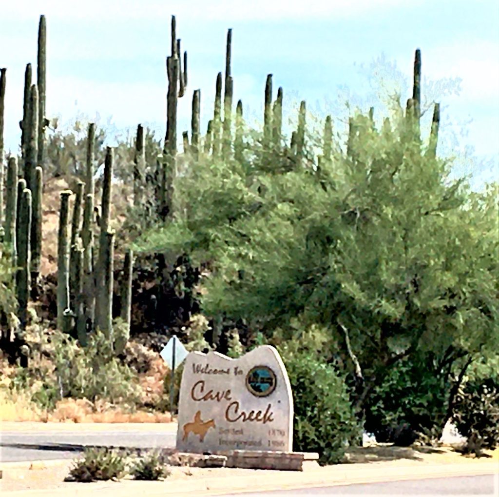
Cave Creek as a town did not receive its official name until the 1870’s. There was and still is a large cave on Cave Creek stream, and most people believe that is the origin of the town’s name. A less popular theory is that Cave Creek was named for Edward G. Cave, an early miner known locally as “Old Rackensack.” I personally think if it had been named for Edward, it would have been called Cave Town or Rackensack – not Cave Creek.
The first wagon road from Phoenix to Cave Creek was built in 1873 and prospectors came north looking for gold. William Rowe created excitement in 1874 with a strike at Gold Hill and in 1877, Cave Creek Station was established.
For the next 42 years, from 1886 to 1928, Cave Creek experienced a series of mining revivals – booms and busts. Schools and post offices were opened and then closed again. Cattle and sheep ranches were established, but decreasing water, overgrazing and federal regulations made them less profitable, and between 1929 and 1950, many became dude ranches. This was the beginning of the tourist industry in Cave Creek.
From 1933 to 1939, the Salvation Army operated a summer camp for children on land they acquired along Cave Creek Road. The building of the Bartlett Dam (1935-39) and the Horseshoe Dam (1940-43) along the Verde River brought boom times again. However, it wasn’t until 1946 that electricity and telephones were available in Cave Creek, and the road from Phoenix to Cave Creek wasn’t paved until 1952. After a long history of struggling to survive, Cave Creek was finally incorporated as a town in 1986.
Today, Cave Creek sits on 37.7 square miles in northern Maricopa County with an estimated population of just over 6000 people. That’s a growth rate of over 20% since 2010. I’ve been a resident since 2002, and the outskirts of town have changed dramatically. When I moved here, there were very few homes past Pima Road on the north end of town. Now there are homes and housing developments all the way to and past the turnoff to Bartlett Lake.
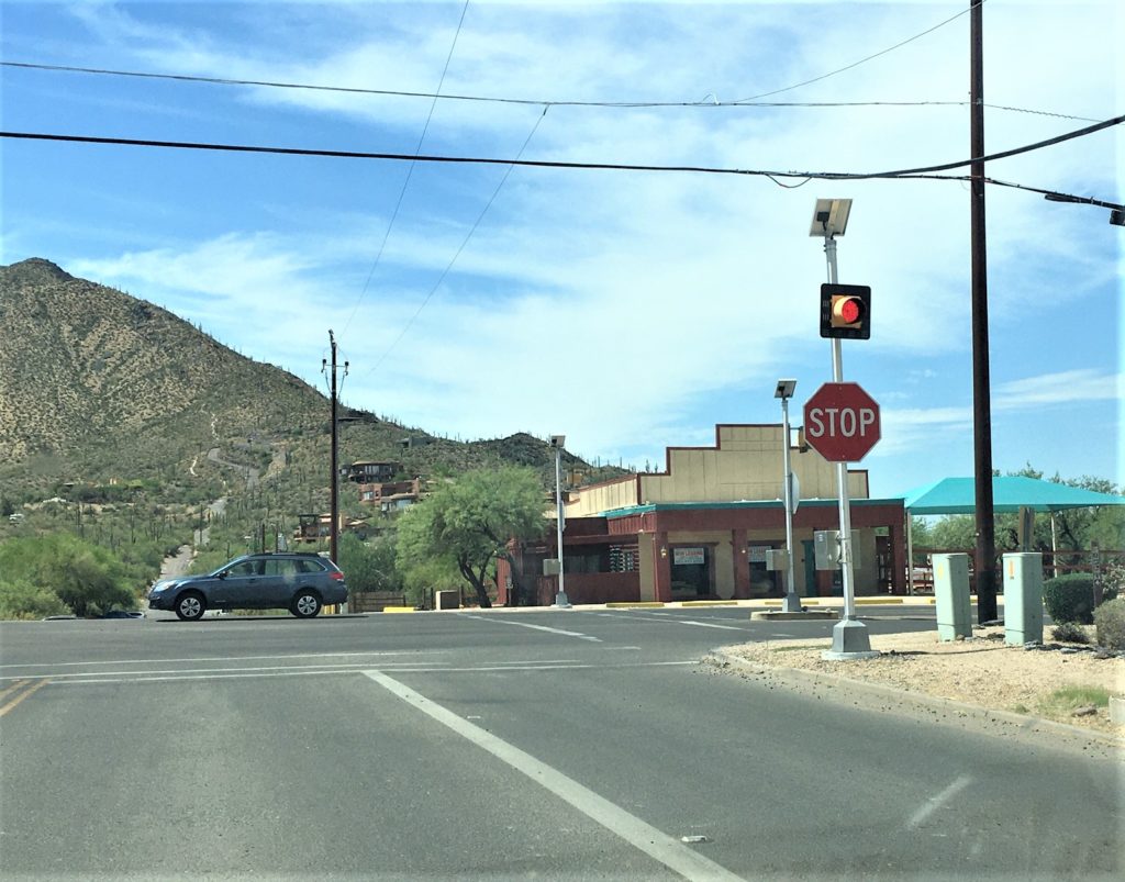
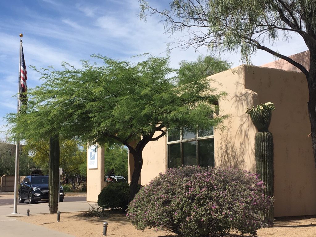
Cave Creek in 2021 is a far cry from a rough and ready mining settlement, but its roots are still evident. It is basically still a western town, but the elegant horse ranches of Spur Cross have made it an upscale one. There are no traffic lights at all in the actual town of Cave Creek, and only two stop signs. We have our very own community library, Desert Foothills, a post office, many restaurants, and a tiny motel. We also boast several resorts, the descendants of the bygone dude ranches, including Rancho Manana and the Villas of Cave Creek.
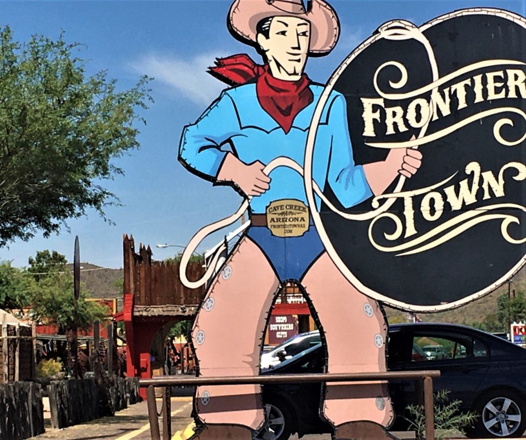
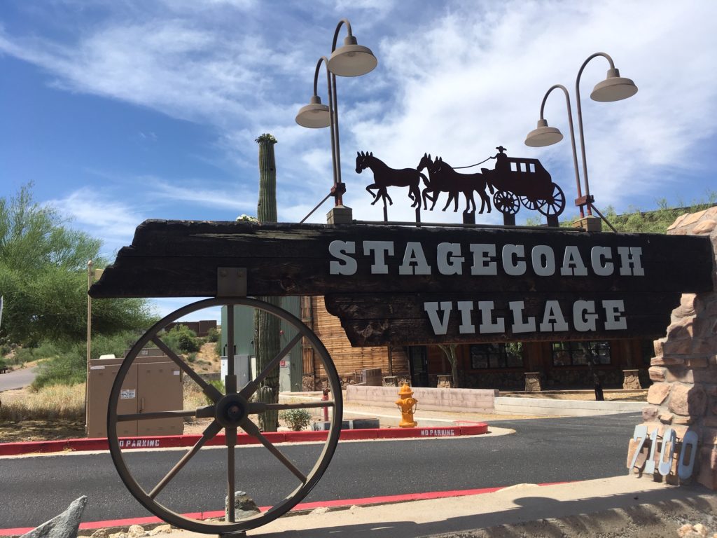
Frontier Town has been the main tourist shopping center for years with quirky shops and a wild west flavor. Stagecoach Village opened just before the economic downturn of 2008 and so it has been slow to fill but has a growing number of nice shops and restaurants, hosts monthly craft markets, and is the home of the Sonoran Art League which sponsors an annual two weekend “Hidden in the Hills” art show.
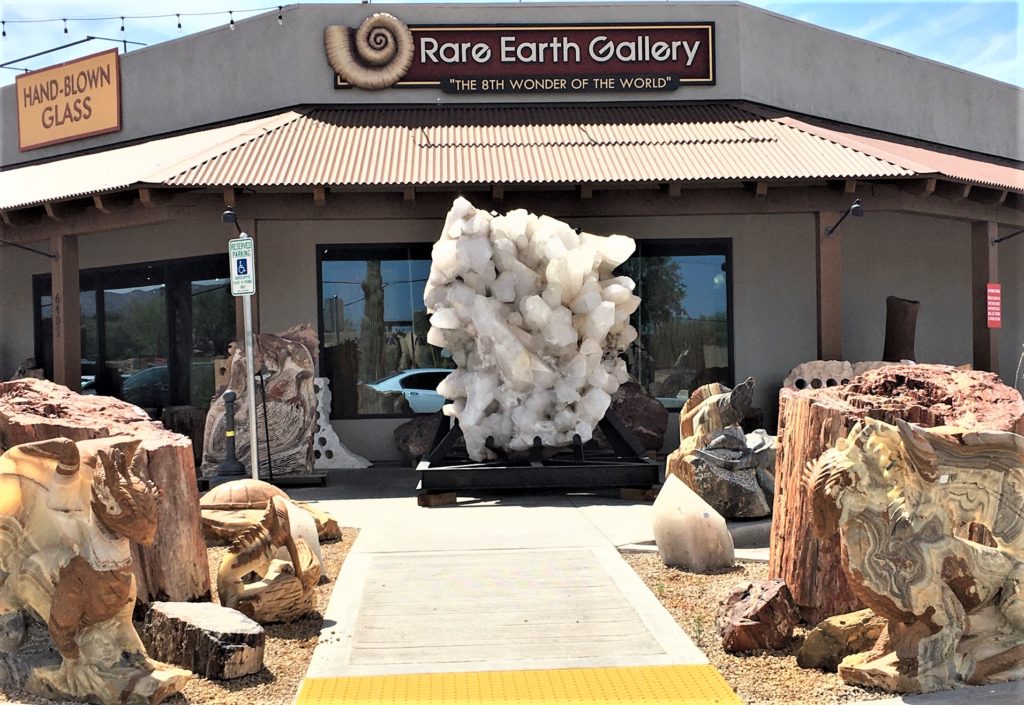
Along Cave Creek Road, you can’t miss Rare Earth, a wonderful store featuring everything rock and mineral, including gems and jewelry, amazing statuary and even rock paintings. It’s one of my favorite places to take visitors because so many things are museum quality.
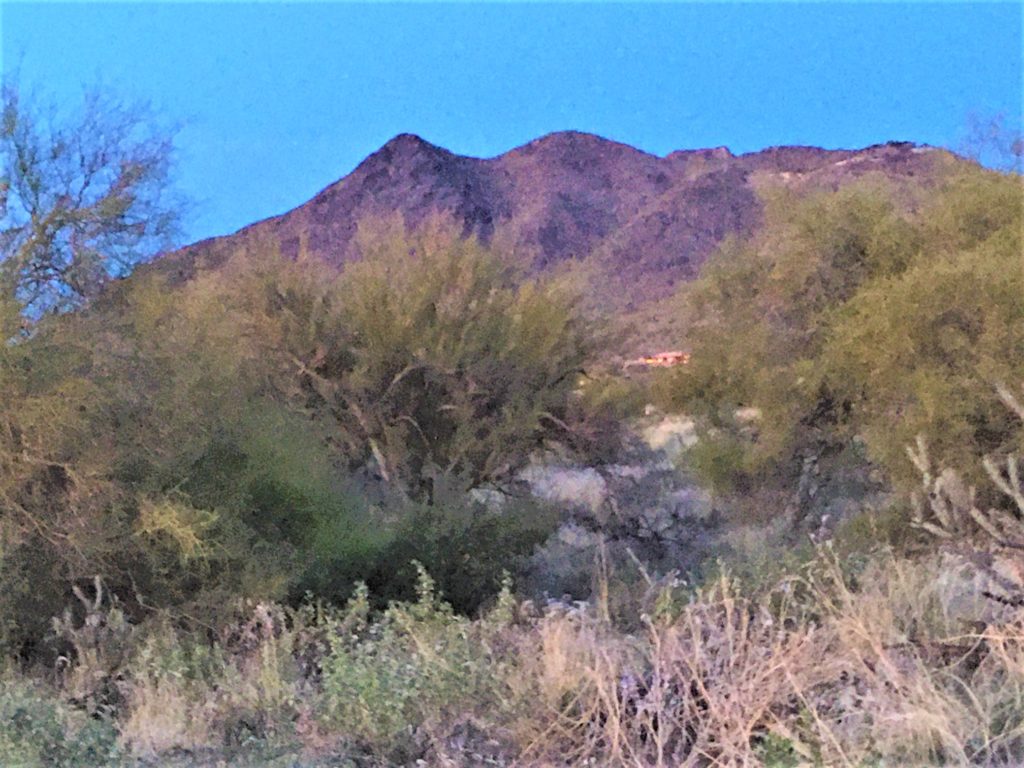
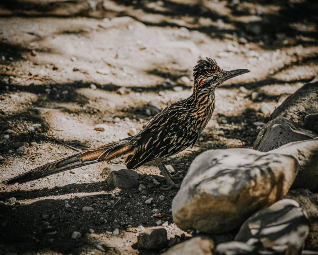
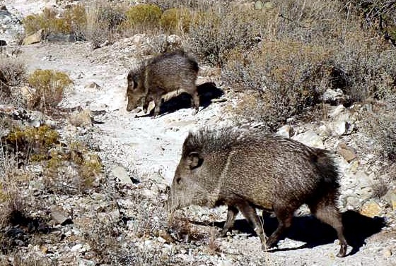
Cave Creek also has a unique feeling – much different from Phoenix or Scottsdale. Perhaps it is the presence of Black Mountain which is visible from quite a distance away and was sacred to the Native Americans who lived here. Perhaps the distant mountains of the Tonto National forest to the north and the smaller hills that surround the area make it feel somehow tucked into the landscape and protected. Maybe the large number of saguaro cactus which grow locally everywhere seem to exude majesty and tranquility. Or maybe it’s because this is a low light and low sound mandated area, regulations geared to protect the native wildlife. We have native deer, javelinas, bob cats, rabbits, road runners, owls, doves, woodpeckers, and lizards everywhere as well as the occasional snake and mountain lion – and having all those neighbors seems to make it an extra special place to live. It’s a great place to visit, but I’m very blessed to live here.